Mt. Helena Continuous Vegetation Inventory
The Eastside Chapter of Montana SAF initiated the Mount Helena Continuous Vegetation Inventory in 2002. The concept was to develop a project that, on a continuing basis, exposed young people to various aspects of forests and forestry. Specific goals were to show each class the variety of plants that occur in a particular forest, the ways that forests change over time and to introduce them to professional inventory equipment and techniques and to possible careers in natural resource fields.
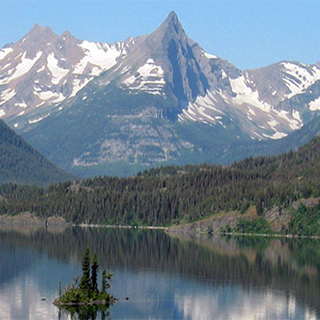
The field site is City of Helena park land on Mount Helena. This area is located on the south side of the city. This area contains 830 acres, of which about 690 acres are forested. Plot centers are located in a grid pattern to provide about one plot for each five acres. A Geographic Information System (GIS) was used to identify the coordinates for the plot centers and Geographic Positioning System (GPS) equipment was used to mark the plot centers on the ground. 147 plot centers have been identified and students were taught compass and pacing techniques to arrive at the plot centers. 122 of those plots have been inventoried over a five year period. The concept is that in the Fall of each year, the students will measure about 20% of the plots.
We are working with 7th grade students at C. R. Anderson Middle School in Helena, Montana. Mrs. Janet Erickson was the lead teacher during the first five years and she had an average of 155 students involved in the project each year. Upon her retirement, Mrs. Leslie Hagengruber took over with her average class size of 60 students. Cooperators with the Eastside Chapter have been an average of 15 natural resource professionals, technicians and volunteers from the Society of American Foresters, Helena National Forest, Montana Discovery Foundation, Native Plant Society, City of Helena, Montana Department of Natural Resources (DNRC) and Natural Resources and Conservation Service (NRCS). Field equipment was purchased with a grant from the U. S. Forest Service in 2003. Plot forms were modified by MSU Extension Forestry from material prepared for their Forest Stewardship training package. Training materials were copied and assembled by the Montana Discovery Foundation.
Over the first five years, 122 permanent plots were inventoried. In the sixth, seventh and eighth years, students remeasured the plots established during the first year three years. That process of remeasuring plots on a five year interval can continue indefinitely. Groups of four to six students coordinate with their natural resource advisor to collect the data on each plot. In recent years, the students have used GPS to relocate the plot centers.
Students have learned the plants that grow in our forested area, how to use the inventory equipment and the frequency that deer use the different forest conditions. Natural resource personnel talk to each group about different site conditions, tree growth patterns and forest disturbances such as fire, insects and noxious weeds. The students utilize the information they collect for up to 7 class periods as part of their math, science, computer and English training. By comparing the data they collect with the original information, they can evaluate growth or mortality. Several students from previous years have volunteered to help current classes. Some of the students have obtained summer jobs with the Helena National Forest forest plan monitoring project.
The City of Helena receives a copy of the data each year. This gives them the information about current forest conditions and how their forest is changing over time.